|
|
||||||||||||||||||||
|
This is a preliminary page illustrating a series
of maps generated of CVDS during 30 Days in ActiveWorlds. The maps were produced using a
combination of the world mapping tools provided by Andras and Foxy, additional rendering
was carried out using 3DMax 2.5. Each map leads to a higher resolution version: Map1 - 30 Days Teleport Map
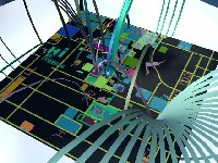
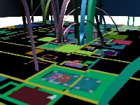
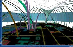
Map 1 illustrates the teleport system created by Day 30 in CVDS. The blue cylinder represents the horizon in CVDS and the sphere the world server. All lines going out towards to the sphere are external teleports to other worlds. Maps 2 and 3 show close ups of the Teleport Map:
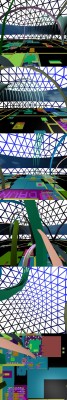
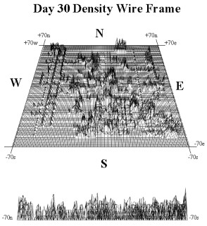
Map 4 illustrates a wire frame rendering of the building density in 30 Days. An interesting observation is that although the majority of the building occurred in the northern regions of the world, the densest building per grid cell took place to the south of ground zero.
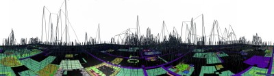
Map 4 Map 5 illustrates the building density draped over the land use map.
Map 5 A Panorama of the wire frame render mapped onto land use is also available, click on the image below to load a JAVA applet enabling a 360 degree view of the world from Ground Zero.
More information and analysis will be made available shortly. email asmith@geog.ucl.ac.uk |
||||||||||||||||||||
University College London |