 |
|
|
A HYPERMEDIA FORMAT FOR DEVELOPMENT PLANS A PILOT STUDY FOR CHELMSFORD Paper by Professor Tony Hall Anglia Polytechnic University It is difficult for a lay person to see how a development plan could affect his or her own property or any other particular site in which they may be interested. To do so normally requires reading several chapters and, hopefully, understanding them. For example, residential development could be affected by parts of the chapters entitled "housing", "design" and, say, for parking matters, "transport". The internal structure of each chapter can be complex and, to the lay person, full of jargon. For the householder who wishes to erect, say, an extension with garage it can be difficult to find and comprehend the particular policies that apply to this particular proposal. It is suggested that a multimedia computer-based development plan could largely remove this problem. Multi-media facilities can enable text, pictures, maps and video recordings to be held in the same computer and be displayed on one screen simultaneously or sequentially. Hyper-media links can enable the user to move directly from a point of reference in one file in one medium to a reference to the same subject in another file in a different medium. In early 1996 an opportunity for a practical case study arose. An experimental hypermedia version of the Chelmsford Borough Local Plan (Chelmsford BC, 1997) was commissioned from the author. The plan documentation consisted of a bound volume of text of 176 pages accompanied by separate maps. The text was divided into 10 chapters plus appendices. The chapters were mostly topic based (e.g. housing, shopping, employment, transport) and contained both policies and proposals. The proposals were cross-referenced both to each other and to the Proposals Map. This map was based on the Ordnance Survey at a scale of 1:25,000 with insets at 1:2500 and 1:10,000. It was overlaid with monochrome notations indicating the areas of land relating to the policies and proposals. Creating hyper-links within the text was a relatively straightforward, if tedious, process. The novel and challenging task was achieving the links to the Proposals Map. A pilot study was embarked upon to test the practicalities of methods of linking. It was decided to base the approach on HTML text. This would have the advantage of use of a standard and very familiar language combined with the ability to access it through the internet. The resulting hyper-media local plan would need to be on a compact disc because of the capacity needed for the maps. A user would access the whole plan from a microcomputer with a CD slot but parts could be read through the internet subject to the time needed to download the graphics. An ASCII file of the text was converted to, and saved as, an HTML file. Microsoft Words Internet Assistance (HTML Editor) was used for formatting the documents and referencing the links to specific policies and proposals. Hence, each file would have a unique name for each proposal or policy and, when combined with the filename, the browser could effectively open a file and display the relevant text on screen. The next step was to scan the map and to give the map references to the above mentioned text. The following factors had to be considered before scanning the maps.
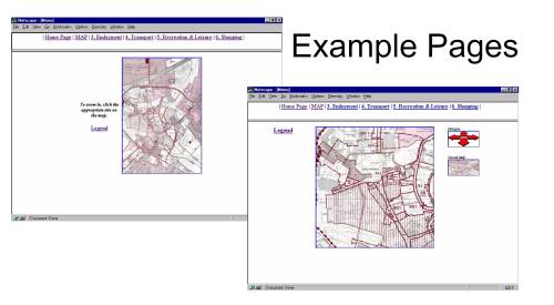
After scanning, each part was then viewed by a paint program, and co-ordinates in pixels of areas to be linked to text were noted. A number of HTML files were then created, each containing reference for one part of the map, reference for links on that part in pixel co-ordinates and reference to text file relating to that link. On loading this file, the browser would display the map and make the links ‘hot’ on it. On clicking the ‘hot’ point, it would immediately load the text file related to the link and display the relevant section. The final step was linking these small area maps to each other for navigational purposes. This was done in a similar way but without references to text. Example pages are pictured below;
The next stage of the work will try two approaches using a computer readable file of the whole Proposals Map which has been prepared for the Borough Council by external consultants. The first will be to continue the technique of using HTML to join "hot spots" on the map with the text via hypertext links. This would have the advantage of keeping the whole application on one compact disk but would be very labour intensive to produce. The second approach to be tried will be to create the links using one of the latest GIS packages. This would have the advantage of ease of production but would mean that a user of the CD would need to have the appropriate GIS system already installed. Longer term developments will lie in the direction of virtual reality and the three-dimensional computer based model. This model can be seen as the frame on which the visual and textual examination of policies is hung in order that such an investigation is accessible to the public in a direct and interactive manner. References CHELMSFORD BC (1997) Chelmsford Borough Local Plan HALL, A. C., KING, D. and WOODROFFE, M. (1994) The Potential of Multimedia for Urban Management. 17th Urban Data Management Symposium, Helsinki. HALL, A. C. (1995) Towards the Multimedia Local Plan, 9th AESOP Congress, Strathclyde University, Glasgow, 18th August 1995 HALL, A. C. (1997) Towards the Multimedia Local Plan, 11th AESOP Congress, University of Nijmegen, Netherlands, 29th May 1997
|
|
|
Editorial | Editorial Board | Articles | Submit | Journal Home | OLP Home |