 |
It is important to underline the existence of horizontal regions and deep and large pit points (especially near the reference section) that turn the modelling of this watershed into a very difficult task.
|
In opposition of what is done in other hydrological modelling packages, the elevation values file that is integrated in MODCHEIAS presents the watershed without any previous modifications (like removing the pit points), wich means the model actually deals with this terrain singularities.
 |
 |
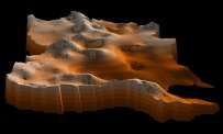 |
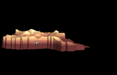
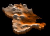
The DTM for this study was obtained from the rasterization of the chart from SCE (scale: 1:25 000). The algoritm to generate the model used bilinear multiquadratic interpolation and the resulting data is a regular grid with 90x91 elements, each one with 142.5m side (166 Km2).
The average elevation of the DTM is 234.25 m, the median elevation is 262.61 m and the average slope is of 9.12 %.
Go back to the main page
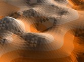
NOTE: The images here presented are from a TIN version of the DTM, generated in Arcview. The animated image is a representation of the model on VRML. This images were only created for display effects and these models didn't took part of MODCHEIAS.