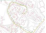
The
positioning data obtained by GPS
i.e. routes that children take is analyzed to explore
what kind of patterns can be found in children's spatial
movements. We are particularly interested in:
-
The difference between the children using a car for
their journey to/from school and those on foot or
using other transport modes
-
The location of the place(s) of interests for the
children e.g. playgrounds, local shops and friends'
house
|